Seaquest Southwest Marine Mammal Surveyor Training

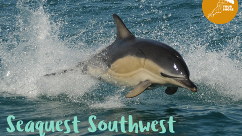
A dolphin jumps out of the sea, water splashing around. Blue text reads Seaquest Southwest, Marine Mammal Survey Training

Seaquest Southwest Marine Mammal Surveyor Training

Online
Book
Train to become a Seaquest surveyor and learn all about Cornwall's marine mega fauna and how to conduct effort based surveys

Event details

Meeting point

Online with practical session at multiple locations

Date

Time
9:00am - 4:00pm

About the event

Seaquest Southwest is a citizen science marine recording project run by Cornwall Wildlife Trust’s Living Seas Marine Team. It is one of the team’s fantastic marine projects aimed at conserving and protecting marine wildlife and wild places for future generations.

Join us for a day course on how to conduct effort based surveys and to improve marine wildlife ID skills for different species of dolphin, porpoise and whales. 

No experience necessary and all are very welcome!

The morning session will include online talks about the project, marine mammal identification and survey technique via a Zoom webinar followed by a practical session in the afternoon of sea watching to practice your new skills at multiple locations around the county, choose from:

· Pendennis Point, Falmouth

· North Widemouth, Bude

· Cligga Head, Perranporth

· St Ives NCI

· Dodman Point, near St Austell

· Perranuthnoe, Mounts Bay

You must attend both sessions to complete the course. Please let us know what practical location you would like to attend when booking.

Final details and running order of the day will be sent by 5pm on Friday 29th November.

Please bring paper and pens, practical clothing and footwear for outdoor work on cliffs and binoculars.

Cost is £20 per person and FREE for volunteers from Your Shore Network Groups (use Promo Code*).

* If you are a member of a local Your Shore group, please contact them directly for the Promo code.

This event is part of the Your Shore Network.

Booking

Price

£20 or free for Your Shore group members with promo code

Suitable for

Adults, Experts, Beginners

Know before you go

Dogs

image/svg+xml
Under effective control

The watchpoints for the practical sessions will be near cliff edges so please keep dogs close and on a lead at all times.

image/svg+xml

Mobility

Each of the six locations for the practical sessions have different levels of accessibility so please choose your location according to your needs and convenience.

Watchpoints will be marked by either a CWT flag and/or staff member in hi-vis. For locations with longer walks from car park, attendees will meet in the car park before walking together as a group to the watchpoint.


PERRANUTHNOE 

Distance & Time: About 0.5 miles (800m) one way, taking 10–15 minutes at a moderate pace.  Terrain: Starts as a compacted trail with a gentle incline; becomes rocky and uneven near the coast, challenging for those with limited mobility. Firm in dry weather but slippery when wet. Parking: Beach car park is close to the path; gravel surface with uneven patches may be tough for wheelchairs. Accessible spaces available but fill up quickly. Fees via cash honesty box.  Toilets: Public toilets, including one accessible, are a two-minute walk from the start of the path.   Accessibility features:  

  • Path: Not wheelchair-accessible; manageable for moderate mobility. 
  • Signage: Clear at start, minimal on path—stay on route. 
  • Quiet Space & Benches: Peaceful with benches near the village and path start; few closer to the point. 
  • Assistance Animals: Welcome, but keep on a lead near cliffs. 
  • Shade: Limited; wear appropriate clothing. 
  • Nearby Café: Café and shops in the village offer refreshments and quiet seating. 


DODMAN POINT

Distance & Time: The walk from the National Trust car park to Dodman Point is about 1.5 miles (2.4 km) one way and takes 30–40 minutes at a moderate pace. Terrain: The path begins flat with a gradual incline but becomes steep and uneven near Dodman Point, which may challenge those with limited mobility. It is generally firm but can be muddy and slippery after rain. Parking: The car park is conveniently located near the trail, with a mostly flat gravel surface and some uneven patches. Accessible spaces are available but fill quickly. Parking is free for National Trust members; non-members may pay a seasonal fee. Toilets: There are no public toilets at the car park; the nearest seasonal facilities are in Gorran Haven. Accessibility features:

  • Path: Initially accessible, but terrain becomes difficult for wheelchair users near Dodman Point.
  • Signage: Clear at the start, minimal along the trail.
  • Quiet Space & Benches: Generally quiet with limited seating but plenty of natural resting spots.
  • Assistance Animals: Welcome but should be leashed near cliffs.
  • Shade: Mostly exposed, so sun protection is advisable.
  • Nearby Café: Villages may offer cafes or shops for refreshments.


PENDENNIS POINT

Distance & Time: The Pendennis Point car park is located directly at the survey site. Terrain: You can survey from the flat, tarmacked car park or a steep hill on the left. While uneven footpaths lead down the headland, it’s not necessary to leave the car park. Parking: The car park features a mostly flat surface with some uneven areas. Accessible parking spaces are available but can fill up quickly. Parking is free for all visitors. Toilets: There are no public toilets at the car park; the nearest facilities are in Falmouth or at Gyllyngvase Beach, requiring a short travel. Accessibility features:

  • Path: Accessible from the car park, but terrain may be challenging for wheelchair users nearer the sea.
  • Signage: Clear signage is available in the car park and throughout the point.
  • Quiet Space & Benches: The area is busy but typically peaceful off-peak, with several seating areas around the headland.
  • Assistance Animals: Welcome but should be leashed near cliff edges and in the car park.
  • Shade: Mostly exposed area with no natural shade.
  • Nearby Café: Refreshments are available in Falmouth and at Gyllyngvase Beach.


CLIGGA HEAD

Distance & Time: The walk from Cligga Head Car Park to the point is about 0.7 miles (1.1 km) one way, taking approximately 15–20 minutes at a moderate pace. Terrain: The path starts well-defined but becomes uneven with rocky sections and small inclines near the point, which may challenge those with limited mobility. The surface is generally firm but can be muddy and slippery after rain. Parking: Cligga Head Car Park, located on St. George’s Hill, has a mostly flat gravel surface with some uneven patches. Accessible parking is available but can fill up quickly during peak times, and parking is free for visitors. Toilets: There are no public toilets at the car park; the nearest facilities are in Perranporth, requiring some travel. Accessibility features:

  • Path: The path is accessible from the car park, but it may be difficult for wheelchair users due to rocky sections.
  • Signage: Signage is present at the car park, but it becomes minimal along the path.
  • Quiet Space & Benches: The area is generally quiet, with no seating available along the path, though the views provide natural resting spots.
  • Assistance Animals: Assistance animals are welcome but should be kept on a lead near uneven terrain.
  • Shade: The path has limited shade and is mostly exposed.
  • Nearby Café: Nearby towns with cafes and facilities include Perranporth, St Agnes, and Porthtowan.


LOWER LONGBEAK POINT, NORTH WIDEMOUTH

Distance & Time: The walk from Viewing Point North car park to Lower Longbeak Point is about 0.1 miles (200m) and takes around 5 minutes at a moderate pace. Terrain: The path near Lower Longbeak Point is uneven with rocky sections that may challenge those with limited mobility, though the surface is generally firm. Parking: The car park has a mostly flat gravel surface with some uneven patches. Accessible parking spaces are available but may fill quickly during busy times. Parking is free. Toilets: There are no public toilets at the car park; the nearest facilities are in Widemouth Bay. Accessibility features:

  • Path: Accessible from the car park, but rocky sections may pose challenges for wheelchair users.
  • Signage: Clear signs mark the route, but there is limited signage along the trail; the path is straightforward.
  • Quiet Space & Benches: The area is popular yet mostly quiet off-peak, with no seating on the path but natural resting spots available.
  • Assistance Animals: Welcome but should be kept on a lead near steep drops.
  • Shade: The path is exposed with no natural shade.
  • Nearby Café: Cafes and shops are available in Widemouth Bay.


ST IVES HEAD

Distance & Time: The walk from The Island car park to St Ives Head is about 0.1 miles (200m), taking around 5–10 minutes at a moderate pace. Terrain: The path starts as a flat, well-defined trail but becomes steep and rocky near St Ives Head, which may challenge those with limited mobility. Parking: The car park features a mostly flat gravel surface with some uneven patches. Accessible parking spaces are available but can fill up quickly. Parking charges apply all year round. Toilets: There are no public toilets at the point; the nearest facilities are at Porthgwidden and elsewhere in St Ives. Accessibility features:

  • Path: There’s a stepped footpath and an accessible road route, though the last 20 meters may be uneven and challenging for wheelchair users. Surveying from near the NCI is a more accessible location.
  • Signage: Clear signage is present at the car park but limited along the path.
  • Quiet Space & Benches: The area can be busy but is generally quiet, with limited seating and scenic resting spots.
  • Assistance Animals: Assistance animals are welcome but should be kept on a lead near steep drops.
  • Shade: The path offers limited natural shade.
  • Nearby Café: St Ives has cafes and shops for refreshments.


Assistance animals are permitted but owners to be aware that other dogs are permitted as well (under effective control). Locations all have plenty of space for individuals to avoid crowds.

image/svg+xml

Wheelchair access

Some locations
image/svg+xmlT

Hearing loop

No
image/svg+xmlP

Parking information

Parking information and location detail for each practical location will be sent out to participants

Contact us

Gemma Newman